Dynamics DC team has extendend standard functionality of Microsoft Dynamics NAV by adding BING Maps. Read more on our blog…
Since Dynamics NAV 2009 Microsoft has introduced support for Control Add-ins. Thanks to that it is now possible to develop an add-on based on C# language, that enhances standard features of the system.
In this article you can read about our extension for Microsoft Dynamics NAV that introduces Bing maps, which is an online service with road maps and satellite and aerial photos. It enables users to find places, roads and directions between two or more points.
Our solution has the following features:
- Displaying a map on a page
- Searching for a place and marking it on a map (based on data from Dynamics NAV)
- Establishing directions:
- Real time traffic conditions;
- Choosing between kilometers and miles;
- Travelling by: foot, car, bike or with public transport;
- Route optimization (shortest time, shortest distance, most cost-effective, fewest transfers, shortest on foot distance).
- Possibility to display pins (indicating places) in different colors
- Displaying additional information about a place after clicking on it
- Finding alternative route(s)
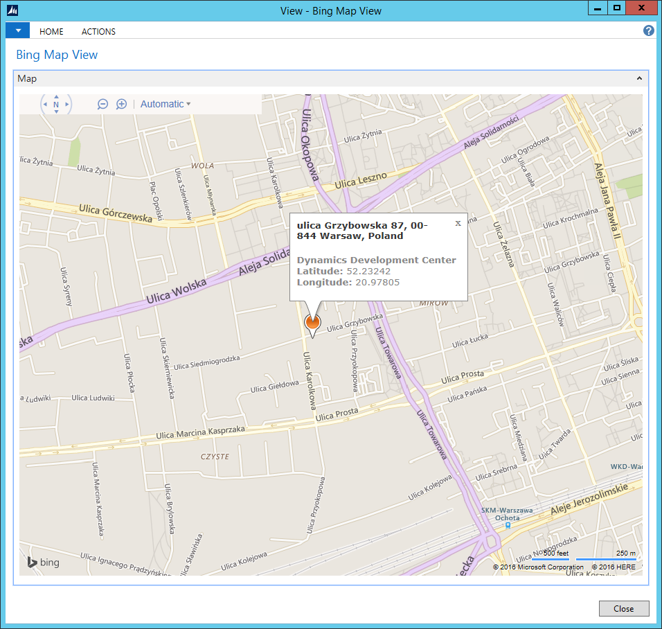
Searching for an address and marking it on the map
Bing Maps can locate a specific point on a map based on queries such as: „Grzybowska 87, Warsaw”. The fact that the point was identified will be indicated by a small icon (pin). You can obtain more information about this place by clicking on this icon.
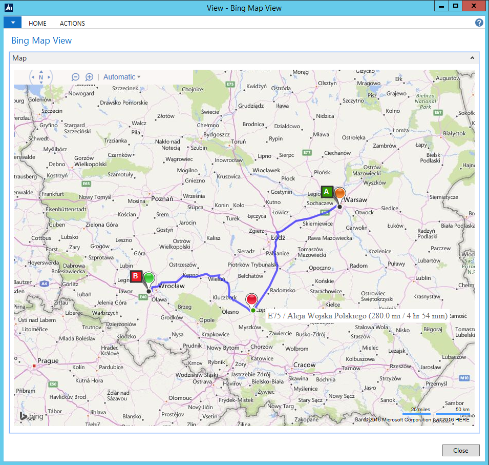
Establishing directions
The solution can provide directions between two places. You don’t need to know a specific address to use this functionality. Bing Maps can also respond to queries such as “Airport Wroclaw”.
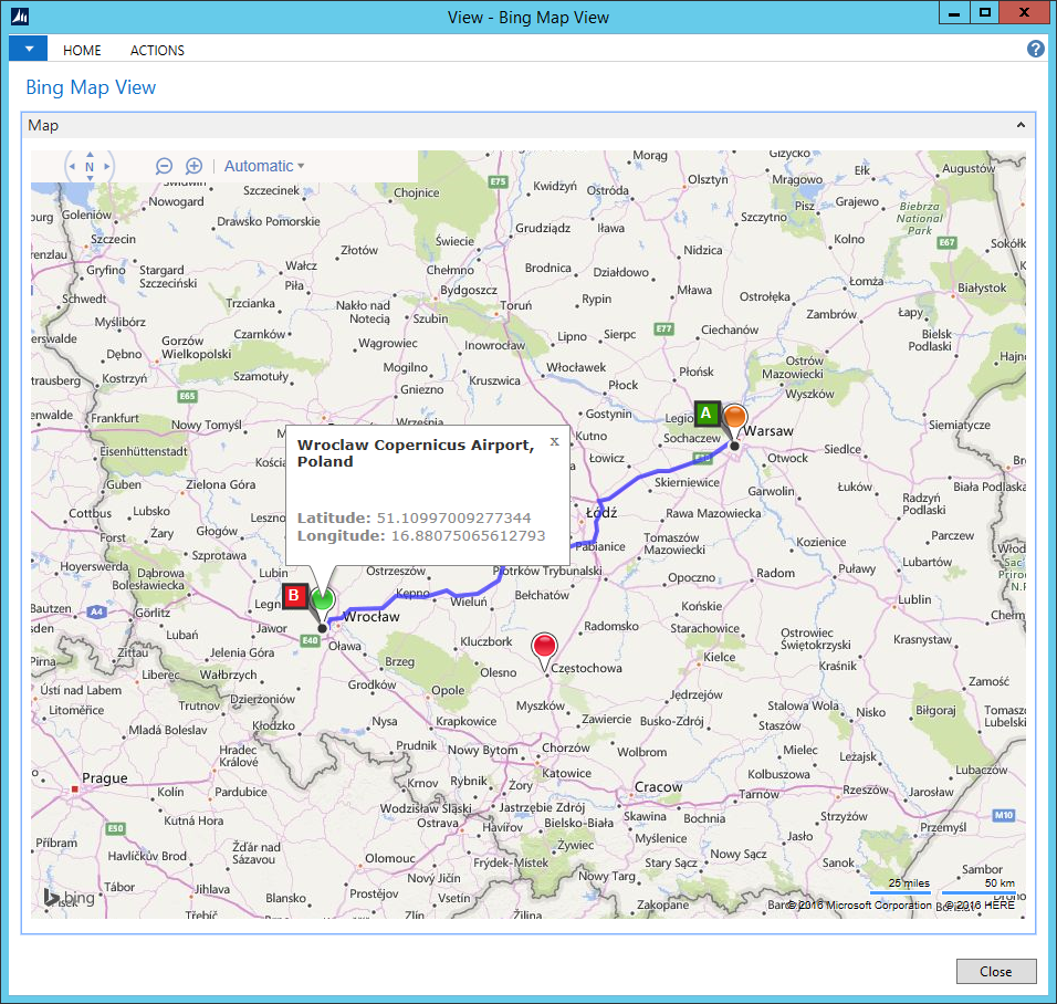
Finding alternative route
It is also possible to alter your route once you generate it. Just hover over a point on your route and drag it to some other location – this will create an alternative route. The system works “live” to establish a new route leading through existing roads. It also displays updated information about a localization, total distance and estimated travel time.